Kemp Lake Waterworks District (KLWD) is located on the west side of Vancouver Island west of Sooke, B.C. The District was established on May 26th, 1953 by Letters Patent under the Water Act of British Columbia. The Letters Patent has been amended a number of times over the years to change the boundaries of the district. The most recent boundary amendment was in 1979. See the bottom of this page for links to both the original Letters Patent and the last boundary amendment document.
The District provides community water to an area of approximately 3.7 square Kilometers(1.44 sq miles) with an estimated population of 1440 people through 231 metered connections, 481 domestic units and 1 commercial unit.
As of May 2020, Kemp Lake Waterworks now purchases water from the CRD via the Juan de Fuca Water Distibution Service. For more background on this see our FAQ page.
We no longer use water from Kemp Lake itself.
Some Old Photographs:
Pump House on shore of Kemp Lake - 1958
The shape of the pump house has not change much over the years. It was rebuilt at some later time with a slight expansion and the roof line sloping the opposite direction.
It was noted that even then, high lake levels would flood the floor of the pump house
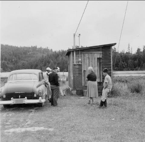
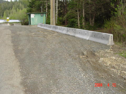
Note that there are no trees or brush around the pump house, whereas now
Chubb Road is lined with trees on both sides around the current pump house
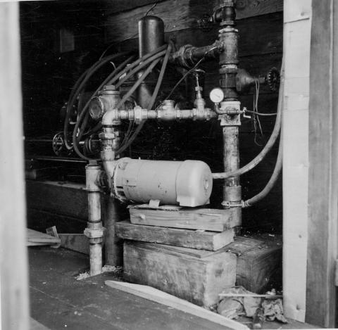
Interior of Pump House - 1958
There were two pumps at this time, the one in the foreground is a Fairbanks Morse 5551D 1 horse power electric pump with a 1-1/2" suction and a 2" discharge. In the background, barely discernable, is a standby 3 horse power reciprocating piston pump driven by a gasoline engine. The original intake pipe appears to have been 150 feet of 6 inch corrigated galvanized pipe.
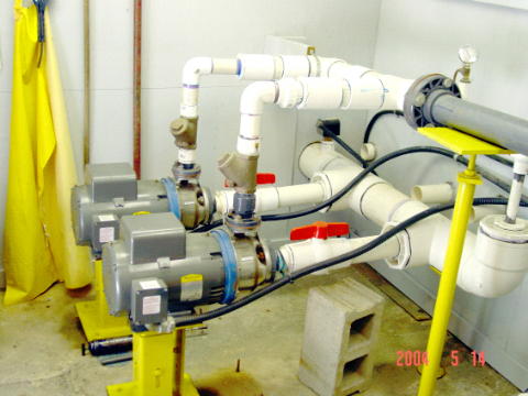
Quite a bit smaller than our current pumping system.
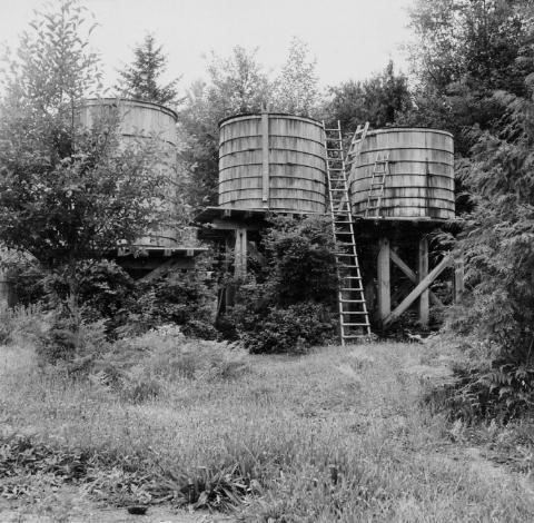
Wood Stave Water Tanks - 1958
These tanks contained approximately 10,000 US gallons and were located in the approximate center of the 84 acre section lying south of Chubb Rd. Two on the right were being used at this time, having a total capacity of about 6,000 US gallons. Only 6% of our current reservoir capacity.
The distribution pipe was originally also wood stave and ran straight down the middle of the valley from the east end of Davidson Road to West Coast road just west of what is now Carpenter Road. The pipe along West Coast road from Kemp Lake road east for about 1,500 feet.
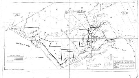
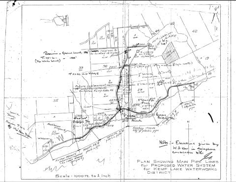
Early Maps of the District
This map showed various stages of proposed modifications and extensions to the pipe lines servicing the district. This plan indicates an intention to run water service west along West Coast road pass Gordon's Beach area to the western end of Otter Point road. This map is actually an old photocopy of the next map, but each map was used for different notes.
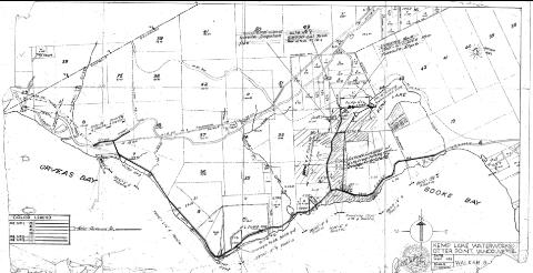
These maps were printed in 1955 and later used to make various notes regarding piping systems in use and proposed. Now it is difficult to tell exactly the state of the system at that time. The various hatching lines show the addition of different sets of properties under a series of boundary amendments.
This map shows the boundary of the district as of October, 1956. It extended all the way pass Tugwell Creek. The district also contained some holes then. For example, most of section 10 in the middle of the map, was outside of the district while a small block of three lots in the left half of section 10 are in the district.
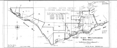
This map showing proposed water system changes for the district dates from 1961. By this time the old tank site had been abandoned and a new established on the west side of Kemp Lake road, just below Chubb road. A new 3 inch water line ran from the pump house, at the lake, along the Chubb road, around the corner onto Kemp Lake road to the new tank site. A 4 inch abestos concrete pipe was run down Kemp Lake Road to the next corner at Davidson road and then east to connect up with the old wood stave pipe running down the valley to a point just west of Carpenter road at West Coast road. The plan also shows the future replacement main running all the way down Kemp Lake road
We would be pleased to hear from any one who has any other historical information, maps and/or pictures.
Please contact us using the link on the upper right side of this website.
